 The Tasmanian Wilderness is mixed World
Heritage Site located in the state of Tasmania state
in Australia. The property is spread over a million
hectares, and it covers 20% of the land of Tasmania.
The site is inscribed as a World Heritage Site because
of the universal values of the rocks and landforms and
the unique properties of the soil. This site is situated
at a remote location. There are no roads, human
settlements, agriculture and other development inside
the area. Within the property many aboriginal sites
were discovered in 1981. These sites are nearly 20,000
years old. A number of these sites are examples of
ongoing and undisturbed karst processes. The area
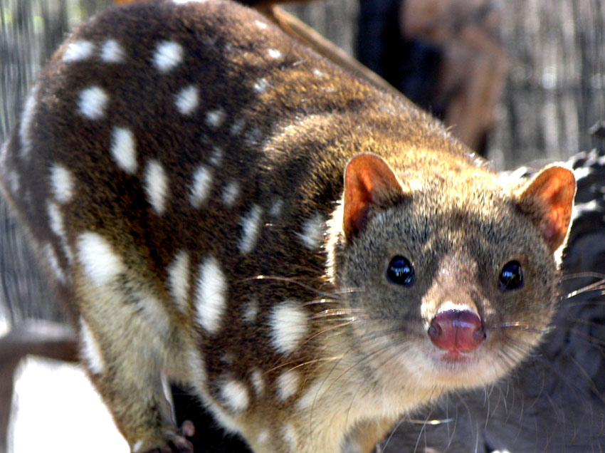
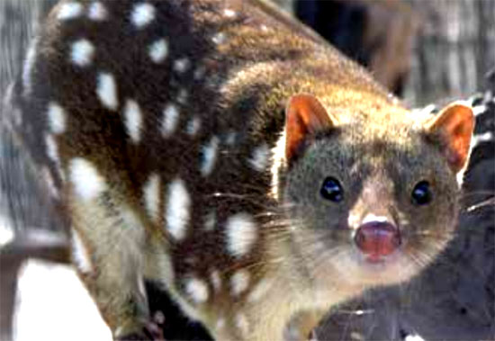
is home to 30 mammal species, of which three are
endemic to Tasmania, and 120 species of bird, of which
10 are endemic to the park. and seven frog species
are reported. The aquatic fauna includes 16 freshwater
species, and 68 marine fish species are found in the
park. The site is managed by the joint Commonwealth &
State arrangements. under which there are a standing
committee of officials and a 15-member consultative
committee of scientific, aboriginal, industry and
recreational interests. It is protected by the National
Parks & Wildlife Act (1970). Threats to the property
include forest fires, pathogens of fresh water, invasive
alien species and impacts of climate change.
The Tasmanian Wilderness is mixed World
Heritage Site located in the state of Tasmania state
in Australia. The property is spread over a million
hectares, and it covers 20% of the land of Tasmania.
The site is inscribed as a World Heritage Site because
of the universal values of the rocks and landforms and
the unique properties of the soil. This site is situated
at a remote location. There are no roads, human
settlements, agriculture and other development inside
the area. Within the property many aboriginal sites
were discovered in 1981. These sites are nearly 20,000
years old. A number of these sites are examples of
ongoing and undisturbed karst processes. The area
is home to 30 mammal species, of which three are
endemic to Tasmania, and 120 species of bird, of which
10 are endemic to the park. and seven frog species
are reported. The aquatic fauna includes 16 freshwater
species, and 68 marine fish species are found in the
park. The site is managed by the joint Commonwealth &
State arrangements. under which there are a standing
committee of officials and a 15-member consultative
committee of scientific, aboriginal, industry and
recreational interests. It is protected by the National
Parks & Wildlife Act (1970). Threats to the property
include forest fires, pathogens of fresh water, invasive
alien species and impacts of climate change.

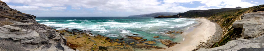
 Tasmania is part of an archipelago consisting
of 334 islands situated between 30 km and 1700 km
southeast of mainland Australia (Sharples 2003). The
Tasmania Wilderness stretches over an area of 1,584,233
ha extent (UNESCO), which includes 20% of the land area
Tasmania (Periodic Reporting Cycle 2003). The place is
a World Heritage Site because of the universal values of
its rocks and landforms and its unique soil properties.
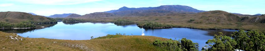
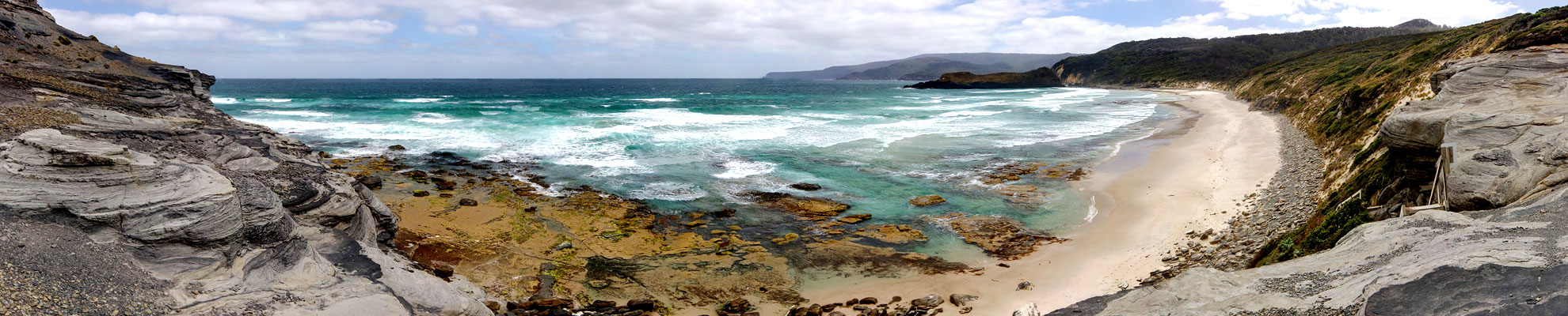
A large portion of the New River basin in southwest
Tasmania falls within the World Heritage Site. The extent
of the basin is 309 km2
. There is no human disturbance
in this area. It has no roads, no human settlements, no
agriculture and no other development.
Tasmania is part of an archipelago consisting
of 334 islands situated between 30 km and 1700 km
southeast of mainland Australia (Sharples 2003). The
Tasmania Wilderness stretches over an area of 1,584,233
ha extent (UNESCO), which includes 20% of the land area
Tasmania (Periodic Reporting Cycle 2003). The place is
a World Heritage Site because of the universal values of
its rocks and landforms and its unique soil properties.
A large portion of the New River basin in southwest
Tasmania falls within the World Heritage Site. The extent
of the basin is 309 km2
. There is no human disturbance
in this area. It has no roads, no human settlements, no
agriculture and no other development.
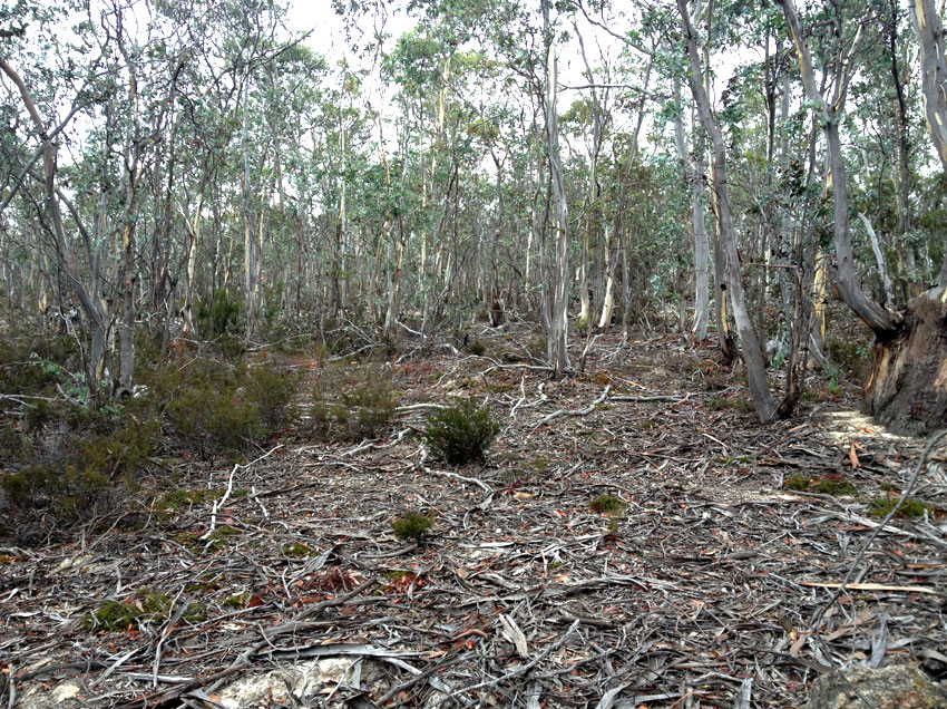
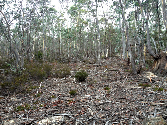
The area is covered by with forests and other forms of vegetation cover, with native species (Houshold & Sharples 2008). A great range of temperatures is experienced in the area, and it has diverse landforms, soils and bedrocks. The rocks of the site are from the Holocene-to-Precambrian period (Sharples 2003). There are records of the Pleistocene aboriginal occupation, 35,000 years back. Holocene middens and the convict history of the 19th century add to the universal values of the property (Russell & Jambrecina 2002).
The property has many aboriginal sites, many of which are 20,000 years old. These were discovered only after 1981. Fraser Cave is the most important of these sites as it is the last human outpost in the Antarctic ice-cap. There are many examples at the site of ongoing and undisturbed karst processes. Paleokarst development, which occurred 400 million years ago, hydrothermal karstification and evidence of past glacio-karstic interactions are also seen in the park (UNEP-WCMC 2012).
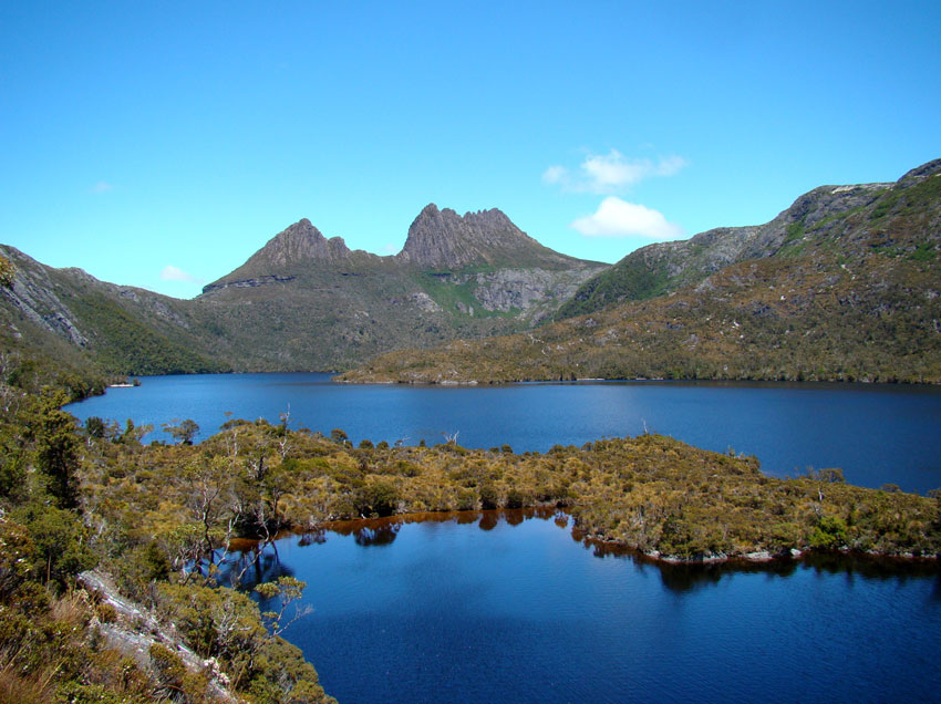
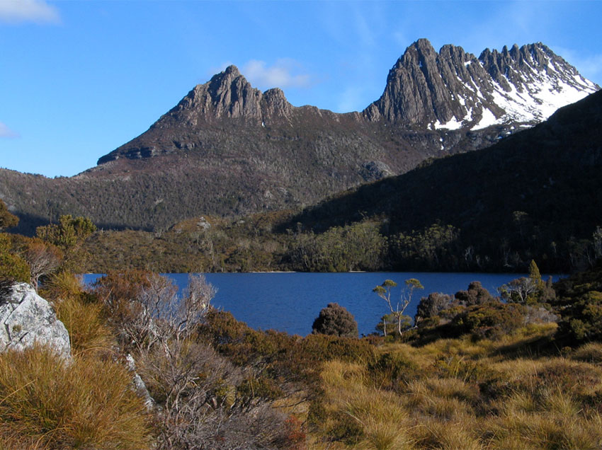
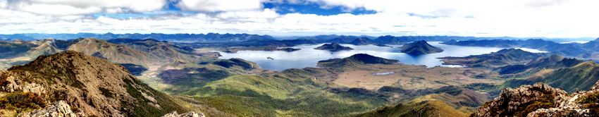
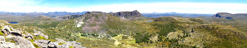
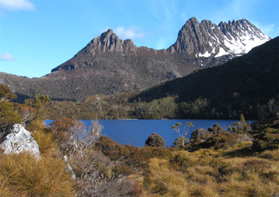
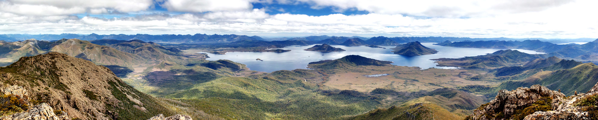
Three national parks of the property-Southwest (442,240 ha), Franklin-Gordon Wild Rivers (195,200 ha) and Cradle Mountain-Lake St Clair (131,915 ha) national parks-together make up the world's last pristine temperate wilderness (World Heritage Nomination 1982). A spectacular view of glaciated landscape can be had within the boundaries of the property, at Cradle Mountain. This is described in the tourist literature as an iconic Tasmanian mountain.
The first management plan of the property (1992-1999) was reviewed after 5 years, and a new plan (a 10-year plan) was framed by the Tasmania Parks and Wildlife Service in 1999 (Russell & Jambrecina 2002). Ninety percent of the park is protected by the National Parks and Wildlife Act (1970). It has been declared by the law that "no statutory powers can be exercised within a state reserve, unless authorized by a management plan."
The property is managed by joint Commonwealth- State arrangements, under which there is a standing committee of officials and a 15-member consultative committee of scientific, aboriginal, industry and recreational interests. Since 1995, the Aboriginal Land Council has been supervising Kutikina Cave (15 ha) and other "parcels of land", and the Aboriginal and Torres Strait Islander Heritage Protection Act (1984) provides the highest protection to the aboriginal sites from violation (Periodic Reporting Cycle 2003). Forest fires were a significant threat to the property, but the implementation of some models helped reduce forest loss by producing some fire-free vegetation. The forest cover increased by 4.1% during the period 1948-1988 and by 0.8% during the period 1988-2010 (Wood & Bowman 2012).
The pets and pathogens of the freshwater are also turning out to be a serious hazard. Pets and pathogens such as Phytophthora cinnamomi (root rot), Batrachochytrium dendrobatidis (chytrid frog disease), Mucor amphibiorum (platypus mucor disease) and the freshwater algal pest Didymosphenia geminata (didymo) are causing harm to the native freshwater species (Allan & Gartenstein 2010). The current threats to the property are quite serious. The "landscape- scale" bushfire of 2000 caused a lot of damage to the property, and 12% of the area got affected, specifically in the high-altitude region of the heritage site The increasing tourism can cause harm to the property. Climate change is having direct and indirect impacts on the property- the increased frequency and intensity of fires is also an effect of climate change, and these fires can cause damage if measures are not taken (IUCN World Heritage Outlook 2020). There is a programme for eradication of feral dogs from the property. Other programmes have been implemented for reducing the numbers of starlings and rabbits (Periodic Reporting Cycle 2003).
 The remoteness, location, limited resources and harsh
environment have provided the area a high degree
of natural protection. The area of the site has been
increased through a series of extensions, as "minor
boundary modifications", in 1989, 2010, 2012 and 2013,
which has provided the property an extra layer of
protection. According to the State of Conservation
Report of 2021, a tourism master plan is being
developed that will provide guide policies and increase
the range of tourism-related experiences available to
visitors. According to the State of Conservation Report
of 2018, the management of the park is effective
and is perpetuating the values of the park. Threats
faced in some areas such as the sea level rise and
effects of climate change cannot be controlled by the
management (IUCN World Heritage Outlook 2020).
The remoteness, location, limited resources and harsh
environment have provided the area a high degree
of natural protection. The area of the site has been
increased through a series of extensions, as "minor
boundary modifications", in 1989, 2010, 2012 and 2013,
which has provided the property an extra layer of
protection. According to the State of Conservation
Report of 2021, a tourism master plan is being
developed that will provide guide policies and increase
the range of tourism-related experiences available to
visitors. According to the State of Conservation Report
of 2018, the management of the park is effective
and is perpetuating the values of the park. Threats
faced in some areas such as the sea level rise and
effects of climate change cannot be controlled by the
management (IUCN World Heritage Outlook 2020).
The monitoring and evaluation of the property for adaptive management is mostly effective, and it commits to providing regular reports of TWWHA (IUCN World Heritage Outlook 2020).